
| Data and Documentation | Chronology and News | Program Status | Publications | Related Data and Resources | Contact Points |
ICOADS Web information page (Tuesday, 11-Feb-2014 19:20:51 UTC):
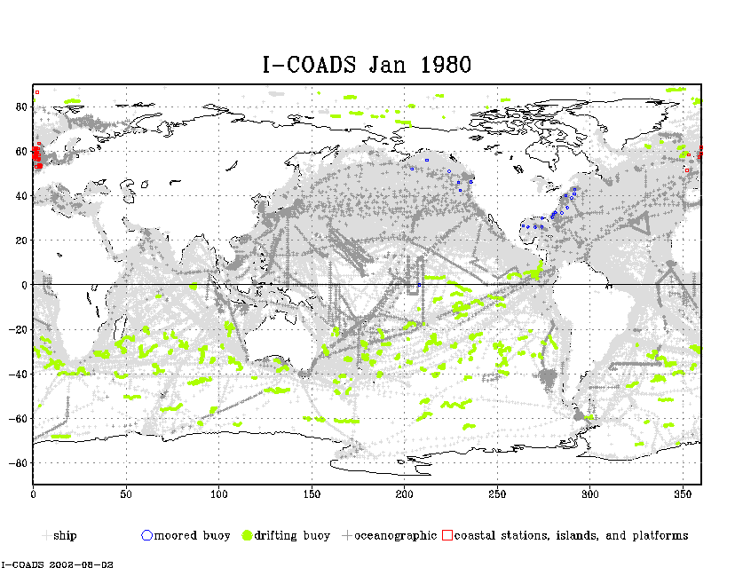
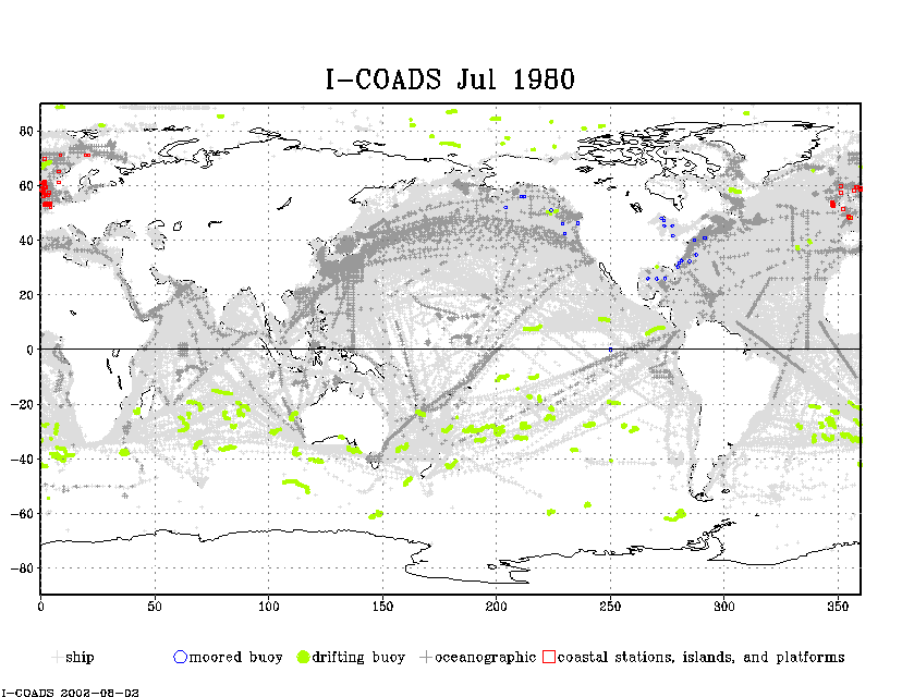
LMRF platform type maps (Release 2.0)
Global maps, for January and July of each year 1980-97, appear below based on
ICOADS Release 2.0 data for these five categories:
     S = ship
     M = moored buoy
     D = drifting buoy
     O = oceanographic
     C = coastal stations, islands, and platforms

Following was the mapping of platform type (PT; right) into category (left):
     S <-  0 = US Navy or "deck" log, or unknown
     S <-  1 = merchant ship or foreign military
     S <-  2 = ocean station vessel--off station or station proximity unknown
     S <-  3 = ocean station vessel--on station
     S <-  4 = lightship
     S <-  5 = ship
     M <-  6 = moored buoy
     D <-  7 = drifting buoy
     D <-  8 = ice buoy [NOTE: currently unused]
     S <-  9 = ice station (manned, including ships overwintering in ice)
     O <- 10 = oceanographic station data (bottle and STD/CTD data)
     O <- 11 = mechanical bathythermograph (MBT)
     O <- 12 = expendable bathythermograph (XBT)
     C <- 13 = Coastal-Marine Automated Network (C-MAN) (NDBC operated)
     C <- 14 = other coastal/island station
     C <- 15 = fixed ocean platform (plat, rig)

Links to global maps:

Jan 1980-1997:            Jul 1980-1997:
gif animation (707 KB)    gif animation (680 KB)
pdf (758 KB)              pdf (725 KB)
[Documentation and Software][Links to additional]
U.S. National Oceanic and Atmospheric Administration hosts the icoads website privacy disclaimer
Document maintained by icoads@noaa.gov
Updated: Feb 11, 2014 19:20:51 UTC
http://www.icoads.noaa.gov/pt.html